
 (850) 213-0040
You have probably read a dozen travel posts about 30A and still cannot picture exactly where Rosemary Beach is relative to Seaside, or whether “30A” refers to a beach, a town, or a region altogether. That confusion is normal. 30A is none of those things, and understanding what is 30A changes how you plan the whole trip.
This guide covers the geography, the 15 communities, what makes South Walton’s coast structurally different from every other Florida Panhandle destination, and how most visitors actually move around once they arrive.
What Is 30A? The Short Answer
Most people searching for what is 30a in Florida expect to find a beach, a town, or a resort name. 30A is none of those.
Scenic Highway 30A is a county road: specifically, Walton County Road 30-A, a 19-mile stretch of the Florida Panhandle coastline running south of US-98 and parallel to the Gulf of Mexico in South Walton County. Florida officially designated it a Scenic Highway on April 9, 2008, but the name had already been the area’s identity for decades before that designation.
The five things you need to know about 30A:
- It’s a highway, not a beach. The road connects 15 communities; the beaches sit south of it.
- 15 distinct towns. Each community has its own character, price point, and architecture.
- 19 miles end to end. The full corridor runs from Topsail Hill Preserve in the west to Inlet Beach in the east.
- 40-foot height limit. No high-rises, no resort towers. This rule is enforced countywide.
- One paved bike trail. The Timpoochee Trail runs the entire length, connecting every community.
The highway connects 15 distinct beach communities in South Walton County, and “30A” refers to the entire corridor, not any single town. When someone says they are going to 30A, they could be staying in Rosemary Beach, Seaside, Grayton Beach, Seacrest Beach, or any of the other communities along the route.
The 30A brand has grown well beyond its county road origins. The 30A lifestyle media company, which is a separate organization from any single business on the corridor, has distributed over four million blue 30A stickers and built a following exceeding 1.5 million across social channels. The sticker is now one of the most recognized marks on the Florida Gulf Coast.
Where Is 30A Located in Florida?
30A runs along the southern edge of South Walton County in the Florida Panhandle, positioned between two of Florida’s most-visited beach destinations: Destin to the west and Panama City Beach to the east.
The western end of the highway begins near Topsail Hill Preserve State Park, close to Dune Allen Beach. The eastern terminus sits at Inlet Beach, which borders the Rosemary Beach community. The drive from end to end is 19 miles on the highway itself.
Drive times to 30A from major cities
| City | Approximate Drive Time |
|---|---|
| Atlanta, GA | ~5 hours |
| Nashville, TN | ~6 hours |
| Birmingham, AL | ~4 hours |
| Charlotte, NC | ~7 hours |
| Tampa, FL | ~5.5 hours |
| Orlando, FL | ~5 hours |
In terms of zip codes, 30A covers two postal areas. The 32459 zip lists as Santa Rosa Beach and covers most of the western and central communities. The 32461 zip lists as Inlet Beach and covers the eastern corridor from Seacrest Beach through Rosemary Beach. Most searches that appear as “santa rosa beach-30a” refer to properties in the 32459 area, which is the larger of the two zones.
Seacrest Beach sits near the eastern end, close to Inlet Beach and Rosemary Beach. It is the primary entry point for visitors arriving from the Panama City Beach airport direction, and it is where the Timpoochee Trail trailhead sits on the eastern corridor.
30A Map: The 15 Beach Communities
30A does not have one center. It has 15 of them.
The communities spread from east to west across the full length of the corridor. They differ significantly in character, architecture, price point, and distance from the Timpoochee Trail trailhead in Seacrest Beach.
Community quick-reference (distances are trail miles from the eastern trailhead, Seacrest Beach)
| Community | Zone | Character | From Seacrest Beach |
|---|---|---|---|
| Inlet Beach | East | Residential, boutique shops | 1.3 mi East |
| Rosemary Beach | East | Georgian/Caribbean architecture, cobblestone square | Under 1 mi East |
| Seacrest Beach | East | Trail hub, eastern trailhead | Home base |
| Alys Beach | East | White Moroccan architecture, stark geometric | 0.8 mi West |
| Prominence | Mid-East | Quieter residential stretch | ~4 mi West |
| Seagrove Beach | Mid | Family cottages, dune lake access | ~7.5 mi West |
| Seaside | Mid | Pastel cottages, amphitheater, The Truman Show | 8.3 mi West |
| WaterColor | Mid | Resort community, Western Lake boat launch | 8.8 mi West |
| Grayton Beach | West | Old Florida character, state park access | 11.5 mi West |
| Blue Mountain Beach | West | Highest Gulf Coast elevation, long views | 12.5 mi West |
| Dune Allen Beach | West | Residential, western access point | ~15.5 mi West |
| Gulf Place | West | Small commercial node, western end | ~16.5 mi West |
Eastern Corridor
The eastern end from Inlet Beach through Seacrest Beach and into Alys Beach runs roughly 3 miles and is the highest-demand stretch for first-time visitors. Rosemary Beach and Alys Beach both have strong architectural identities: Rosemary Beach draws from Georgian and Caribbean design, while Alys Beach is built in a white Moroccan style with stark geometric buildings and private courtyards. Seacrest Beach sits just west of Rosemary Beach and anchors the Timpoochee Trail’s eastern starting point.
Mid-30A Corridor
Moving west, Seagrove Beach and WaterSound sit between the eastern communities and Seaside. Seaside is the most-recognized name on 30A globally, in part because The Truman Show (1998) was filmed there. Its pastel cottages and open-air amphitheater look exactly as they did on screen. WaterColor operates as a resort community with private beach access and a boat launch on Western Lake, one of the 15 coastal dune lakes. The Santa Rosa Beach zip covers most of this mid-30A zone.
Western Corridor
Grayton Beach anchors the western mid-section and is the oldest community on 30A in character, with old-Florida wooden cottages, canopy roads, and access to Grayton Beach State Park. From Grayton, continuing west takes visitors through Gulf Place and into Dune Allen Beach, where the terrain and the crowd density both change noticeably.
Blue Mountain Beach: The Highest Point on the Gulf Coast
Blue Mountain Beach sits in the western mid-section of 30A and deserves more than a bullet point.
At approximately 65 feet in elevation, Blue Mountain Beach is the highest natural point along the entire Gulf Coast of the United States. The elevated dune line creates long, unobstructed views down the coastline that are simply not available anywhere else on 30A or on the broader Panhandle.
The community itself is quieter than Rosemary Beach or Seaside. There are fewer commercial properties, no cobblestone squares, and no famous filming locations. That is exactly why visitors searching specifically for blue mountain beach florida as a destination tend to be repeat visitors who have already done the eastern corridor and want something different. The views and the pace are the product.
What Makes 30A Different from Destin and Panama City Beach
Two specific rules govern development on 30A that do not apply to Destin or Panama City Beach.
The first is the 40-foot building height limit. No structure on 30A may exceed 40 feet. This is why the skyline from any point on the corridor looks like a neighborhood rather than a resort strip. There are no high-rise condos, no 20-story towers, no structures that block sight lines to the Gulf from the road.
The second is the coastal dune lakes. According to Visit South Walton, the official tourism council for South Walton County, the region’s 15 coastal dune lakes are found in fewer than five locations worldwide, with the only other known examples in Madagascar, Australia, New Zealand, and Oregon.
30A vs. its Panhandle neighbors at a glance
| Feature | 30A | Destin | Panama City Beach |
|---|---|---|---|
| Building height limit | 40 ft | No cap | No cap |
| High-rise hotels | None | Many | Many |
| Coastal dune lakes | 15 | None | None |
| Paved bike trail linking all areas | Yes (19 mi) | No | No |
| Distinct named communities | 15 | 1 city | 1 city |
| Dominant crowd type | Families, couples | Mixed resort | Spring break, large resort |
These are not retention ponds or freshwater lagoons. They are rare geological formations: shallow, irregularly shaped bodies of water sitting just inside the sand dunes that separate them from the Gulf. Following heavy rainfall, the lakes periodically breach their sand berms and drain directly into the Gulf, mixing fresh and salt water in a way that supports unusually high biodiversity along the shoreline.
The sand itself is also a distinction. South Walton beaches are nearly 100 percent quartz, a composition unusual along the broader Florida Gulf Coast. Quartz reflects light and heat differently from shell-aggregate or limestone beaches, which is why 30A sand looks and feels different from the beaches an hour east or west.
How to Get Around 30A Without a Car
Getting between communities is where most first-timers overcomplicate the trip.
The practical answer is the Timpoochee Trail.
The Timpoochee Trail is a 19-mile paved path that runs the full length of Scenic Highway 30A. The trail is completely separated from vehicle traffic and passes through or directly alongside every community on the corridor. The surface runs through coastal scrub oak canopy for long stretches, with Gulf views opening between the vegetation at regular intervals.
Timpoochee Trail quick facts
- Total length: 19 miles, end to end
- Surface: Paved asphalt throughout, no gravel sections
- Grade: Flat for the entire length, no hills
- Traffic separation: Fully separated from vehicle lanes
- Communities connected: All 15, plus multiple beach access points
- Eastern trailhead: Seacrest Beach
- Western trailhead: Dune Allen Beach, near Gulf Place
The trail is not a cycling destination in the athletic sense. It is the transportation infrastructure for 30A. Visitors who cover the most ground and spend the least time looking for parking are the ones who ride it.
Ride times from the eastern trailhead at Seacrest Beach
| Destination | Direction | Trail Distance | Approximate Ride Time |
|---|---|---|---|
| Rosemary Beach | East | Under 1 mi | Under 10 min |
| Alys Beach | West | 0.8 mi | ~5 min |
| Prominence | West | ~4 mi | ~20 min |
| Seagrove Beach | West | ~7.5 mi | ~40 min |
| Seaside | West | 8.3 mi | ~42 min |
| WaterColor | West | 8.8 mi | ~44 min |
| Grayton Beach | West | 11.5 mi | ~58 min |
| Blue Mountain Beach | West | 12.5 mi | ~60 min |
Parking at Rosemary Beach on a summer Saturday requires cash, patience, and some luck. The parking situation at Seaside during peak season is genuinely difficult and time-consuming. Visitors who ride the Timpoochee Trail bypass both entirely.
Rent a bike at the Seacrest Beach trailhead and get a helmet, lock, and trail map included. Walk-ins are welcome for individual riders.
Best Things to Do on 30A, Florida
The Timpoochee Trail connects every activity on this list. Most of these stops are reachable by bike from anywhere on the eastern corridor in under an hour.
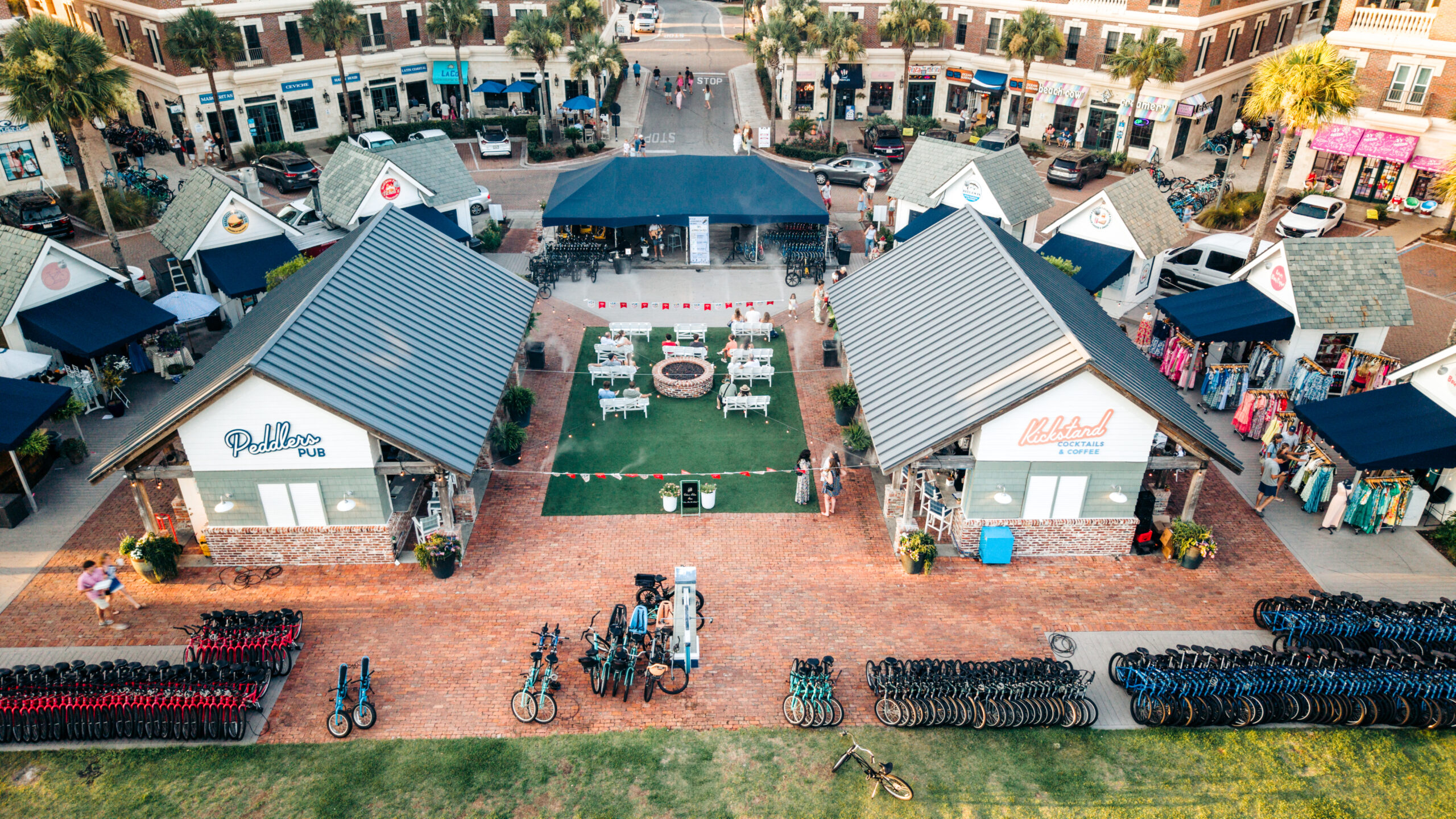
- Peddlers Pavilion, Seacrest Beach. Not just a bike rental hub. The Pavilion brings together half a dozen food and drink vendors under one roof: Charlie’s Donuts, Ticheli’s Pizza, Kickstand Coffee and Bar, Sweet Peddler ice cream, Reel ‘Em In seafood, and Beachside Burger Co. Live music runs most evenings in summer, and the fire pits and open seating make it a natural meeting point. It also sits directly at the eastern trailhead, so every ride starts and ends here.
- Rosemary Beach town square. Cobblestone courtyard, independent coffee shops, and architecture that belongs in the Caribbean more than the Florida Panhandle. The community sits immediately east of Seacrest Beach, making it the first major stop on a morning ride. The main square is walkable and compact, built for exploring on foot once you lock up the bike.
- Seaside Amphitheater and Saturday Farmers Market. The social center of 30A. Live music, local vendors, and the filming locations from The Truman Show (1998). The open-air amphitheater hosts regular events. The Saturday farmers market runs through the warmer months and draws visitors from across the corridor.
- Grayton Beach State Park. 2,200 acres of protected coastal habitat, hiking trails, and canoe access into Western Lake, one of 30A’s 15 coastal dune lakes. The beach here is consistently ranked among the best in Florida. Plan for a full afternoon rather than a quick stop.
- Coastal dune lake kayaking. Several of the 15 lakes have public launch access. The paddle into Western Lake from Grayton Beach State Park is one of the most specific outdoor experiences available on the Gulf Coast. The mix of freshwater and occasional Gulf overflow creates an ecosystem that looks nothing like a typical beach lake.